

I'm writing this sitting in the Holiday Inn Express at Los Angeles Airport. Tomorrow we fly home, so this will be our last post. There's not a lot to do at the Holiday Inn, so I'm pretty bored. As a result this is a photo-heavy post, and it is quite possible that I will ramble on.
Innes and I have enjoyed the last two weeks of our trip. After climbing for a few days in Lander, Wyoming, we had both had enough of steep pocketed limestone. We also couldn't ignore the fact that there were some fantastic mountains and beautiful wilderness nearby. We decided that we had time for one last mission to climb a big, remote mountain. Our plan was to have a go at Gannett Peak, which at 4,200m is the highest peak in Wyoming. Although the peak is not technically difficult to climb, it is about 20 miles from the nearest road so another mini-expedition was in order. We somewhat optimistically planned to do it in three days - the first day to walk 20 miles to camp by a lake called Titcombe lake a few miles from Gannett Peak, the second day to cross a high pass and climb the mountain and return to Titcombe lake, and the third day to walk back out to the road. We set off carrying three days' food, tent and minimal climbing equipment - a short rope, slings, crampons and ice axes.
Gannett Peak is in the Wind River Range. The mountains are made out of granite, and there are many lakes. It is one of the most beautiful places that I have ever been - I hope that this comes through in the photos. The flowers in particular were fantastic. We were impressed by how many people we met on the walk in, so far from the road. Some were going fishing or hiking, some were like us going for Gannett Peak. It turns out that Gannett Peak is on the tick list for a breed of people called "State Highpointers", whose mission it is to climb the highest peak in each state. I guess they are a bit like Munro-baggers, but as the State highpoints include Mount McKinley (Denali) at over 20,000 feet, I think it's probably a tougher challenge. We met a couple of guys who were on their fourth attempt to climb Gannett Peak. Fair play to them - it takes a lot of commitment to do a 20 mile walk in more than once.
The walk in took us about 7 hours on the first day. In the afternoon it started to piss with rain, and we got pretty soaked. Luckily it cleared when we got to our campsite and we were able to cook our dinner outside in the dry. We set our alarm clock for 4.00am, so that we could get up the peak early in the morning while the snow was still firm. We knew that the technical crux of the route was a bergschrund with a fragile snow bridge, which could be dangerous late in the day. However it was not to be. Soon after we went to bed it started raining, and it continued to rain all night. It was still raining half an hour before we were supposed to get up, so we decided to go back to sleep. You have to really want to climb a mountain to get up in the dark and rain at 4.00am in the hope that the weather will improve. For us Gannett Peak was just a bit of an excuse to go backpacking in some beautiful wilderness. Maybe one of these days we will be brave enough to leave the climbing gear behind and admit that we just want to go for a big walk.
As it happens we made the wrong call on the weather - it turned out to be a beautiful sunny day - ideal for climbing Gannett Peak in fact. We weren't too bothered though, and spent the next two days walking back out to the road via the same route. I'd love to go back to the Wind River Range to explore a bit more. There are acres and acres of rock.
After our attempt on Gannett Peak we had just over a week left. Time to visit one more venue. We decided to go to Maple Canyon in Utah. This is a sport climbing venue with probably the weirdest rock I have ever climbed on. The rock is conglomerate, made up of large quartzite cobbles in a cement-like matrix. It looks like the cobbles would just come out in your hand, but they are actually pretty solid. The climbing is great fun - mostly very steep and on positive holds. One crag is an enormous cave which apparently is big enough to fit a basketball court inside (I don't really know how big that is, but it looked pretty big to me). The canyon itself is a very nice spot, with cheap camping and plenty of shade.
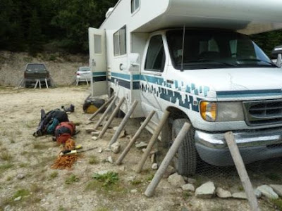
Then it was finally the end of our trip - time to pack all of our stuff, clean the RV, and point it in the direction of Los Angeles. This morning we dropped the RV off, and we were sad to say goodbye to the Sport Jamboree. After all, it's been our home for six months.
So that's it. Thanks for reading our blog. I hope you've enjoyed it. We've had a fantastic time but are ready to come home. We're really looking forward to seeing all of you soon after we get back.
best wishes
Ruth
Photos from the top:
1. Lake in the Wind River Range on the walk in to Gannet Peak.2. Me walking towards where we would camp at the end of Titcombe lake in the rain. Despite the rain we appreciated the beauty of this valley.
3. We appreciated it even more the next morning when it stopped raining
4. The view from our tent
5. Island Lake, on the way back from Gannet Peak. We saw a lot of people fishing for trout in this lake. We also saw what we decided to call a sea eagle, which came swooping down into the lake and caught a fish.
6. Bear proof food storage in the Wind River Range. I'm not convinced that a bear couldn't get at the food, but we did what we were told we should do.
7. Me on Le Spunk .12a, Maple Canyon
8. Pipe Dream Cave - you can see all the fixed quickdraws hanging down. Some of the routes have as many as 30 bolts and are almost entirely horizontal. We watched some locals climbing them by deploying sneaky knee bars
9. Box Canyon - this is a narrow, 200 foot high canyon. It had some good climbing but was a bit dark
10. Cheddar Tomato Fondue - America's idea of a classic recipe. Bear in mind that it would be made with classic orange American cheese. A Frenchman would be disgusted.


