Sunday, 31 July 2011

Fire and Flood

After leaving Los Angeles we drove about 250 miles north to a climbing area called the Needles, in Sequoia National Forest in the southern part of the Sierra Nevada mountains. The Needles consist of 150m high granite towers, which have names like "the Witch", "the Sorceror" and "the Magician". The rock is beautiful orange granite streaked with bright yellow lichen. It's at about 8,000 feet, so not too hot in the summer.
The Needles are also famous for the Needles Lookout, which is a building owned by the US Forest Service perched on the top of the biggest tower, the Magician. The purpose of the Lookout is to keep a watch for forest fires, and a Forest Service employee is stationed there during the summer months.
Forest fires are obviously a big issue in this bit of California - while walking in to the Needles we could see a big forest fire not far away, which we were told was covering an area of several thousand acres.
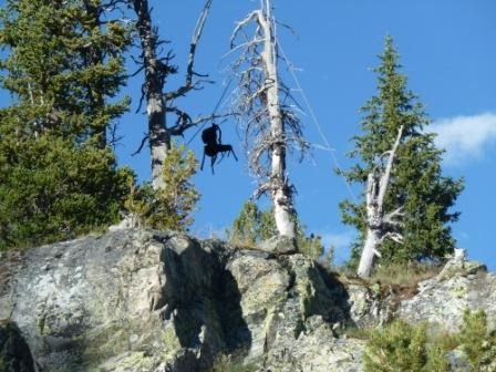
Lots of people had told us that the climbing at the Needles was brilliant. They weren't wrong. The towers are split by beautiful clean cracks which give really striking lines, which look really hard but aren't as hard as they look (like the climbers in this picture, who we think are on a 5.10b called Thin Ice)
We started off by doing a route called Igor Unchained, 5.9, which takes the crack system that splits the headwall in this picture
It was good but hard for 5.9 we thought - or maybe our crack climbing skills are a bit rusty. Unfortunately, Igor Unchained turned out to be the only route which we got done at the Needles, for a reason that we would never have thought of. When we walked in to climb on the second day, there was smoke coming out of the roof of the Lookout. As we passed the stairs at the foot of the Lookout we met a rather agitated young lad, who was the grandson of the woman who worked there. He told us that the roof was on fire, and the fire had been caused by them burning paper in their stove. Helicopters had already dropped seven huge bucketfuls of water on it, and he thought it was under control. He told us we should be OK going climbing. To get to the routes you have to pass right underneath the Lookout, but reassured by what he had said we carried on. A few minutes later we turned back to look at the Lookout, and while we were watching big flames engulfed it - it went up incredibly fast.
At this point we decided to get out of there - we could see that the building would disintegrate, and bits of burning wood would start falling down into the tinder dry forest below. The Lookout was in between us and the path back to where we had parked the van, and we didn't fancy getting cut off. We were influenced by the fact that we had no experience of forest fires, and no way of knowing whether or not it was sensible to stay in the area. We then had a slightly hairy walk back past the burning Lookout (we could hear the propane tanks exploding, and see bits of the building falling down the cliff above us). Once we got to a safe distance we met lots of fire fighters. They were glad that we had decided to leave, and told us that the area would be closed and evacuated. By this time there was smoke coming from the forest below the Lookout, so it looked like the fire might spread. There was no water anywhere close by (it is 3 miles to the nearest road) we couldn't see what the firefighters could do to put it out. There was definitely a certain irony in a fire being started by the person who was supposed to be responsible for keeping a lookout for forest fires.
We decided to leave the Needles, as we were told the area might be closed for several days. Before we left we went to visit a grove of giant Sequoias. They are amazing - it took my breath away to see a living tree that was so big and so old.
Then we drove round to the town of Lone Pine, at the base of Mount Whitney. Whitney is the highest mountain in the Lower 48 States, so is pretty popular. Access is regulated by a permit system, so we were pretty happy to be able to get a permit to walk in and camp overnight for the next day. We planned to walk in, camp, and then do the East Buttress to the summit the next day. This is a classic rock climb, about Hard Severe, and we really wanted to do it. However it wasn't to be - we were thwarted by the elements again. It rained all day the day before we were supposed to walk in, and when we got up the next morning to drive up to the trail head, we came up against this road block
Apparently the road had flooded, and both the road and all the trails up Whitney were closed. They were rescuing people off the mountain by helicopter, and expected it to be closed for at least the rest of the day.
Since then the weather has been bad for the last couple of days - not what we expected in Southern California. We've managed a bit of cragging while we wait for the weather to improve, and today we were reduced to going for a run in the rain - good altitude training as we were running at 10,000 feet! Hopefully we should get another shot at trying Mount Whitney over the next few days.
Ruth

In America now...

We arrived in Los Angeles a few days ago and picked up the van which will be our home for the next 6 months...
Its pretty cool. Its a Dodge Ram 3500 conversion (Ruth has therefore named it 'The Ram'). Its much newer than the Sport Jamboree, and the good thing is that everthing works, even the air-con which is good thing at this time of year in California.
Anyway here are few pictures... more blogs to come asap.
Innes

Friday, 22 July 2011

Back again... this time at the 'Best Crag in the World'?

Ceuse
Rumours of the death of our Blog have been greatly exaggerated...
As our friends will know, Ruth and I both quit our jobs a few weeks ago. All this is due to us having had such a good time when we went on our last trip to the US that we decided that we needed to do it all again. So we are resurrecting this blog to post more photos and news of how we are getting on with our next big trip.
Although we are going back to the US again for 6 months (the limit of our entry visas) because we don't have jobs to go back to this time we decided that we might as well go somewhere else first. We decided to start our trip this time by going climbing at the "Best Crag in the World" - namely Ceuse in France. Not a bad place to start really?

Alpine flowers at the Ceuse campsite

The climbing at Ceuse is at the top of a 1,800 metre high mountain (it actually has a small ski restort on top), and to get to the crag from the campsite involves a 1 hour uphill slog and over 500 metres of ascent up a reasonably steep hillside. So although it's just sport climbing, it actually involves quite a big day out. Especially as it's 30C at the campsite and you have to carry 6 litres of water up the hill to stop yourself dehydrating, on top of everything else you need to take climbing. The actual rock climbing is pretty hard when you get to it as well.

Sector Demi Lune at Ceuse

The first few days at Ceuse proved to be a bit hard on the ego. Ruth and I were definitely in 'office shape' and both the approach walk and climbing seemed way harder than we would have liked. So much so that I failed on my first 'warm up' route, and Ruth didn't want to lead anything for several days as the routes can be quite bold, with big falls being on the cards if you blow the moves in the wrong position. However, the climbing is brilliant and we persevered.

Ceuse enforces a slightly strange routine on a climber as it's too hot to climb in the sun at this time of year, so you must wait for the shade which reaches the crag around 3pm. To accommodate this you adopt the following routine:- pitch your tent in the shade of a big tree and sleep as late as you can each morning; get up have breakfast, then cook your evening meal, and then have lunch; set off at 1:30pm to walk up to the crag; climb as hard as you can in the shade from about 3:00-9:00pm; walk down (often by headtorch in the dark) and eat your pre-cooked evening meal about 11:00pm; and then sleep. Now repeat...

Ruth and I spent nearly 3 weeks at Ceuse, every day hiding a stash of ropes and assorted climbing equipment in the forest just below the crag so we didn't have to carry everything up the hillside the next day. 12 days of climbing out of 18 spent camping at the hillside - 3 days climbing in a row was the most we managed before we were knackered and needed to rest - Nibs will be proud of us ;-)

Despite our slow start we both managed to end up climbing quite well. In fact, Ruth managed to climb (on-sight) her first ever 6C, and also climbed a beautiful 7a+ called 'Noir sur Noir' - which is probably the best route that either of us managed to climb on the crag. Not bad after not wanting to lead anything for the first few days!

I managed to surprise myself on a few things too (probably by finding the few soft touches at Ceuse). Nevertheless, it seems like I might be currently on better form than I was when I last went to the US. I can't complain about that then - and luckily we are not planning to start our US trip at J-Tree, so our egos may remain intact.

After our time at Ceuse, and with just a few days remaining before we had to be back to London for our flights to the US, Ruth and I decided that we had had enough of sport climbing and that we were going to try and climb something a bit bigger in the Alps. The weather was looking shaky anyway. We left Ceuse and drove into the Ecrins...

I won't dwell on this bit of our trip to France. Cold weather swept in from the northwest, which is actually what Ruth and I were looking for, but it came with a huge amount of rain - much more than was forecast. We ended up not even being able to drive to La Berarde, where we wanted to camp for the night, as the rainstorms had caused an impressive landslide of mud and huge boulders that had completely blocked the only road to the village.

We spent an entertaining half-hour watching a very aggressive CAT driver attack the landslide and try to dig out the road and some entombed cars - all under the 'watchful eye' of a foreman (in the grey coat, below) who stood on top of the still active landslide as the CAT driver bull-dosed the rubble away from beneath his feet. Go figure....!

Alpine-style highway maintenance on the road to La Berarde (there is actually a road under this lot)
Ruth and I ended up being comprehensively washed out of the Alps by the weather. Sometimes the extent to which your ambitions are shut-down can be entertaining. This time it was by an impressive alpine storm involving hailstones the size of marbles, which made me glad I was in the valley and not on some peak up high. We left the Alps and returned home via Fontainebleau. The bad weather followed us, and nowhere in France was spared. We managed a few greasy hours at Col de Chien. We are now in London at Sheona's flat packing for our flight to the US, which leaves on Sunday. Best regards to all, Innes

Tuesday, 31 August 2010

The last post

I'm writing this sitting in the Holiday Inn Express at Los Angeles Airport. Tomorrow we fly home, so this will be our last post. There's not a lot to do at the Holiday Inn, so I'm pretty bored. As a result this is a photo-heavy post, and it is quite possible that I will ramble on.
Innes and I have enjoyed the last two weeks of our trip. After climbing for a few days in Lander, Wyoming, we had both had enough of steep pocketed limestone. We also couldn't ignore the fact that there were some fantastic mountains and beautiful wilderness nearby. We decided that we had time for one last mission to climb a big, remote mountain. Our plan was to have a go at Gannett Peak, which at 4,200m is the highest peak in Wyoming. Although the peak is not technically difficult to climb, it is about 20 miles from the nearest road so another mini-expedition was in order. We somewhat optimistically planned to do it in three days - the first day to walk 20 miles to camp by a lake called Titcombe lake a few miles from Gannett Peak, the second day to cross a high pass and climb the mountain and return to Titcombe lake, and the third day to walk back out to the road. We set off carrying three days' food, tent and minimal climbing equipment - a short rope, slings, crampons and ice axes.
Gannett Peak is in the Wind River Range. The mountains are made out of granite, and there are many lakes. It is one of the most beautiful places that I have ever been - I hope that this comes through in the photos. The flowers in particular were fantastic. We were impressed by how many people we met on the walk in, so far from the road. Some were going fishing or hiking, some were like us going for Gannett Peak. It turns out that Gannett Peak is on the tick list for a breed of people called "State Highpointers", whose mission it is to climb the highest peak in each state. I guess they are a bit like Munro-baggers, but as the State highpoints include Mount McKinley (Denali) at over 20,000 feet, I think it's probably a tougher challenge. We met a couple of guys who were on their fourth attempt to climb Gannett Peak. Fair play to them - it takes a lot of commitment to do a 20 mile walk in more than once.
The walk in took us about 7 hours on the first day. In the afternoon it started to piss with rain, and we got pretty soaked. Luckily it cleared when we got to our campsite and we were able to cook our dinner outside in the dry. We set our alarm clock for 4.00am, so that we could get up the peak early in the morning while the snow was still firm. We knew that the technical crux of the route was a bergschrund with a fragile snow bridge, which could be dangerous late in the day. However it was not to be. Soon after we went to bed it started raining, and it continued to rain all night. It was still raining half an hour before we were supposed to get up, so we decided to go back to sleep. You have to really want to climb a mountain to get up in the dark and rain at 4.00am in the hope that the weather will improve. For us Gannett Peak was just a bit of an excuse to go backpacking in some beautiful wilderness. Maybe one of these days we will be brave enough to leave the climbing gear behind and admit that we just want to go for a big walk.
As it happens we made the wrong call on the weather - it turned out to be a beautiful sunny day - ideal for climbing Gannett Peak in fact. We weren't too bothered though, and spent the next two days walking back out to the road via the same route. I'd love to go back to the Wind River Range to explore a bit more. There are acres and acres of rock.
After our attempt on Gannett Peak we had just over a week left. Time to visit one more venue. We decided to go to Maple Canyon in Utah. This is a sport climbing venue with probably the weirdest rock I have ever climbed on. The rock is conglomerate, made up of large quartzite cobbles in a cement-like matrix. It looks like the cobbles would just come out in your hand, but they are actually pretty solid. The climbing is great fun - mostly very steep and on positive holds. One crag is an enormous cave which apparently is big enough to fit a basketball court inside (I don't really know how big that is, but it looked pretty big to me). The canyon itself is a very nice spot, with cheap camping and plenty of shade.
Then it was finally the end of our trip - time to pack all of our stuff, clean the RV, and point it in the direction of Los Angeles. This morning we dropped the RV off, and we were sad to say goodbye to the Sport Jamboree. After all, it's been our home for six months.
So that's it. Thanks for reading our blog. I hope you've enjoyed it. We've had a fantastic time but are ready to come home. We're really looking forward to seeing all of you soon after we get back.
best wishes
Ruth
Photos from the top:
1. Lake in the Wind River Range on the walk in to Gannet Peak.
2. Me walking towards where we would camp at the end of Titcombe lake in the rain. Despite the rain we appreciated the beauty of this valley.
3. We appreciated it even more the next morning when it stopped raining
4. The view from our tent
5. Island Lake, on the way back from Gannet Peak. We saw a lot of people fishing for trout in this lake. We also saw what we decided to call a sea eagle, which came swooping down into the lake and caught a fish.
6. Bear proof food storage in the Wind River Range. I'm not convinced that a bear couldn't get at the food, but we did what we were told we should do.
7. Me on Le Spunk .12a, Maple Canyon
8. Pipe Dream Cave - you can see all the fixed quickdraws hanging down. Some of the routes have as many as 30 bolts and are almost entirely horizontal. We watched some locals climbing them by deploying sneaky knee bars
9. Box Canyon - this is a narrow, 200 foot high canyon. It had some good climbing but was a bit dark
10. Cheddar Tomato Fondue - America's idea of a classic recipe. Bear in mind that it would be made with classic orange American cheese. A Frenchman would be disgusted.

Saturday, 14 August 2010

Goodbye to Canada

Sorry for the long silence. Here's an update on our last couple of weeks in Canada.
After Mount Assiniboine we took a few days to recover. Then we decided that we'd like to do something a bit different, so we went to explore an area to the east of Canmore called the Ghost River Wilderness. This is an area of slightly lower limestone peaks, which looked to have a lot of good climbing. It is also pretty remote and outside the National Parks, which means that you are allowed to camp where you want and there's generally less bureaucracy. We planned to go in and camp for a few days, and do a bit of cragging. After Assiniboine we fancied something fairly non-serious.
There was only one problem with this plan - 20km of dirt road which turned out to be too rough for the RV. We decided to walk in anyway, so with heavy rucksacks containing food for four days we set off. After about 20 minutes we discovered the second problem - the mosquitoes. I've never experienced mosquitoes that bad. I thought that they were worse than Scottish midges. The little buggers were even biting me through my clothes. We soldiered on, but unfortunately the mosquitoes ruined the experience for me. Innes didn't seem to suffer from them so badly. We also hadn't reckoned on how tired we would be from walking in, which meant that we didn't get much climbing done. Still, I'm glad we went to the Ghost River - it's really beautiful, and the climbing potential is massive. If it were in Europe, there would be a thousand routes. As it is there are only about a hundred. It's good rock too - solid limestone, as opposed to the more shattered stuff you get on the higher mountains.
Back in Canmore we started to think about going to the Bugaboos, an area of Alpine granite peaks about 100 miles to the south. We'd been looking forward to going there since we saw Kimm's photos from his trip a couple of years ago. What was slowing us down was that we couldn't seem to get weather forecasts that made any sense. Frustrated, we decided to ignore the weather forecasts and go anyway. After our Ghost River experience we fancied a bit of luxury (and lighter rucksacks) so we booked some space in the Alpine Club of Canada Hut in the Bugaboos.
The next challenge was to get there. The trailhead to walk in to the hut is at the end of 50km of dirt forest road. Ever since we'd arrived in America we'd been asking people who had been to the Bugaboos if they thought we could get the RV along the road. The consensus was that we'd probably be OK, but we weren't sure. In the end it was OK, but very nerve-wracking, and it took 3 hours to go 50km. Innes did a very good job of off road driving.
Once at the trailhead, we walked up to the hut. Two days of good weather were forecast, followed by rain and more unsettled weather. We decided to start by doing an easy, classic route called the West Ridge of Pigeon Spire. This was a fantastic day out - moderate climbing, solid rock and brilliant views. Unfortunately I wasn't feeling very well, and started feeling worse as the day went on. This meant that Pigeon Spire was the only route we got done in the Bugaboos, because I wasn't feeling up to doing much and the weather was going to deteriorate. We decided to leave, but we'd like to go back - it's an impressive place.
At this point our thoughts started to turn slightly homeward, so we headed south. We've got to fly home from Los Angeles on 31st August, so we are (very slowly) on the way there. From the Bugaboos we drove south for two days, over the border back into the US (luckily they let us back in) then through Montana to Wyoming. We're now in a place called Lander, where we have been doing some sport climbing. The climbing is good, and the crags are in a beautiful setting, but it's all pocket-pulling so a bit hard on the fingers. Today Innes is nursing an injured finger, and we're thinking of maybe having a few days off climbing and going to check out Yellowstone National Park, which is not that far from here.
See you all soon - not long now until we get home.
Ruth
Pictures from the top (they are in reverse order - sorry I'm too stupid to work out how to get them in the right order)
1. Me on Zorro 11d at Wild Iris at Lander, Wyoming - see what I mean about pocket-pulling?
2. The view from Wild Iris - it's at 9,000 feet and you feel that you are on top of the world. We camped up there for a few days.
3. Me on the West Ridge of Pigeon Spire in the Bugaboos. This bit of the ridge is traditionally done "a cheval" (ie sitting astride it) but we thought walking along the top would be more fun - it felt very exposed.
4. Pigeon Spire - we climbed the ridge on the right hand skyline.
5. The RV in the Bugaboos car park. You have to build a fence of chicken wire around your vehicle. Apparently if you don't porcupines and other critters will get in and chew your tyres and brake cables.
6. One of the many big cliffs at Ghost River. We didn't do any routes on this cliff as we hadn't brought enough gear, but it looked to have some good lines on it.
7. Innes crossing the Ghost River. It was damn cold.
8. Our campsite in Ghost River. Looks idyllic because you can't see the mosquitoes.
Pictures from the top:

Tuesday, 27 July 2010

Mount Assiniboine and Squamish

Ruth and I have been really busy recently, with the last week being perhaps the most jam packed yet. So here goes ...
When we arrived in Squamish after Skaha we were both dead tired. Pretty much exhausted. I think it was the heat of summer, or perhaps a bad case of Sea Level Lassitude. Anyway, we weren’t too enthusiastic for climbing for a while. Fortunately the Squamish Mountain Festival was running at this time, and we could entertain ourselves by going to presentations and films which were going on over a 5 day period. These ranged from the hilarious, to the tragically sad, and were generally all very good apart from one, which unfortunately was the British film.

Somehow between fighting off the lassitude each morning and attending the ‘mountain culture events’, we managed to get some good routes done. The highlight was probably doing a route called The Grand Wall. This is a world famous climb, and probably justifiably so. It climbs perhaps the most impressive wall at Squamish, and includes the infamous ‘Split Pillar’ pitch. I tried to take pictures of this pitch when we were on the climb but it’s not really possible to do it justice from these angles. If you want to know why this climb is famous you should check out this: http://www.rockclimbing.com/photos/Featured/Simon_Carter/Split_Pillar_95727.html .

Pretty cool, eh?

As it turns out, the Grand Wall isn’t actually as difficult as its reputation would lead you to believe. It is a lot of fun though!

We climbed the Grand Wall last Monday. It was our last route before leaving Squamish. To put things in perspective, we only really went to Squamish and Skaha because summer had not really arrived yet in the high mountains. At this time we decided that we were going to back into the Rockies to take another look, so we drove for 2 days to get back to Canmore in Alberta, on the back of what looked like a developing period of good weather. We had a few ideas in mind, but gradually settled on a plan as we crawled along the Trans Canada Highway yet again, and could see how the forecasts developed and what the mountains were looking like as we passed them. We decided to have a go at climbing Mount Assiniboine.

Mount Assiniboine is one of Canada’s most famous and iconic mountains. It is known as ‘The Matterhorn of the Rockies’ because of its striking appearance (see the picture above). It is also quite a long way from any roads – about 20 miles into the wilderness to get to the bottom of the mountain.

To cut quite a long story as short as I can:

Our plan was to walk in to Mt. Assiniboine, climb it by its North Ridge, and walk out again within a 4 day period, carrying with us everything we needed to be an independent mini-expedition. This is exactly what we ended up doing...

On day one it took us just over 6 hours to walk in the pissing rain into a place called Lake Magog, near the base of the mountain where we were to spend the first night camping. Also located here is The Assiniboine Lodge – a sort of surreal hotel in the wilderness, where those with very deep pockets can be flown in by helicopter to be wined and dined and taken on day tours around the wilderness trails. Here we talked to a bloke called Sepp Brenner – a silver haired mountain guide from Switzerland, and proprietor of the Lodge. Sepp has climbed the mountain more times than anyone else, and is a really good bloke. He told us that there was still a lot of snow on the mountain (we couldn’t actually see it then because it was completely obscured in cloud), and that the mountain had not yet been climbed this year! Lots of teams with professional Mountain Guides had cancelled their trips so far.

I will admit to thinking “oh shit!” at this point.

Given that Ruth and I both must have looked like slightly pathetic drowned rats at this point, Sepp understandably looked at us slightly suspiciously and quizzed us a little. But, he pulled out a weather forecast which was exactly what Ruth and I had previously seen – good weather arriving the day after tomorrow. Sepp also gave us some tips on our route up the mountain, which were to be really useful.

It continued to rain all night and we got a pretty good soaking in our tiny tent a couple of kilometres further on from the Lodge. We had decided that we were going to stick to our original plan, and so used the next day to climb to a hut at the foot of the North face of the mountain. The clouds even lifted momentarily that morning to give us a look at the mountain – this is the top picture on this blog. You can use your imagination to decide what we were thinking when we saw it!

Ruth and I got to the hut by mid afternoon. At this point two things happened which I think kind of consolidated our plans: the weather cleared exactly as forecast; and we were joined in the hut by two other climbers – a single Mountain Guide and his client who were going to attempt the same route up the mountain as we intended to climb (they had flown in by helicopter earlier that day). It was a boost to know that we wouldn’t be alone on the mountain.

I’ll save the blow-by-blow account of climbing the route for those of you who might understand what on earth I’m talking about. In brief, we left the hut by 4 am the next morning to start our attempt on the route. The weather was perfect: there was no wind, the stars were out, and the snow was frozen hard. We were past the guide’s team by sunrise, climbed probably faster than we’ve ever climbed as a team, stormed the ridge via a detour on the North face, and were standing alone on the summit before 9 o’clock in the morning – the first to summit Canada’s iconic Mount Assiniboine in 2010! Check out the pictures...

How’s about that then?

The descent back to the hut was down pretty much the same line as we had climbed up. It was pretty arduous ridge descent work (something Ruth and I seem to be making a habit of?) It took much longer to get down than it did to climb up the thing, and involved a lot of abseiling and down-climbing. Overall, we took about 12 hours for the climb ‘hut-to-hut’, which I think is pretty darn good given the condition of the mountain.

The next day we descended from the hut back down to Lake Magog, dropped in at the Assiniboine Lodge to pay our hut fees (they were very complimentary and gave us lemonade to drink), and then pressed on and walked the whole way back to the road head. It took us 10 hours with only the briefest of stops. We were totally ******* [insert word meaning ‘very tired’].

So there you have it. The Grand Wall at Squamish and the first to summit Mount Assiniboine in 2010, walking in and out, all within one week.

Does this excuse us for not having updated the blog recently Sheona? ;-)

We are in Canmore trying to recover at the moment. Our feet look a bit like they’ve been worked over with a steak tenderiser, and they hurt. The weather forecast is superb. It looks like summer has finally arrived.

Innes

Photos in order from the top (but sort of in reverse chronological order – sorry Squamish, but you get the bottom of the listings!):

1. Mount Assiniboine seen from the Lake Magog on the morning of day 2. From this perspective the North Ridge takes the direct line up the front of the summit pyramid, between the shadow and the vapour trail.

2. Ruth packing our kit at the car park before starting the walk into Assiniboine (before anyone asks: no, we didn’t take the bouldering mat!)

3. Ruth on the lower section of the North Ridge, Mt Assiniboine, taken about 6 am.

4. Ruth on the upper section (approaching the Grey Band if you want to check it out) of the North Ridge, Mt Assiniboine.

5. Summit cornices, Mt Assiniboine.

6. Assiniboine summit 08:43 hrs, 24th July 2010 – mark one up for Team UK ;-)

7. A bull Moose. I was really pleased to see this geezer on the way into Assiniboine. He was bloody huge despite being relatively young, I think, judging by his antlers.

8. The Grand Wall, Squamish. Not so big really, but a nice piece of rock and with a cracking good route up it.

9. Ruth jamming up the Split Pillar pitch of the Grand Wall. If you look really closely in the top left you can see another climbing team starting up the wall.

10. Ruth emerging from the squeeze chimney finish to the Split Pillar.

11. Ruth negotiating the Bellygood Ledge on the Grand Wall. If you want to know why Ruth is in this position, and how the Bellygood Ledge got its name you’ll need to try and get across it yourself!

12. Ruth looking burly on the Squamish boulders.

Tuesday, 13 July 2010

Canada #2

Sorry for being so slack about updating the blog. It's so long since we wrote anything that I have started to forget what we have done.
After doing the route on Mt Gimli that Innes described in the last post, we were knackered and had to have two days' rest, which we spent driving slowly back to Canmore in the Rockies. We were lured back there by the promise of scorchio weather, although we later discovered that weather forecasts in Canada are pretty unreliable. The main thing that we did in Canmore was a route called Sisyphus Summits. This is a 21 pitch sport route right to the top of a mountain called Ha Ling. We had camped below this mountain last time we were in Canmore, and had spent a lot of time looking up at the line of Sisyphus but had felt that it would be too cold and windy to get on it. It turned out to be a brilliant route - exposed, a good line and sustained and technical at 5.10d (about French 6c, non-climbers just glaze over this bit).
After doing Sisyphus we decided to leave the mountains for a bit - all the higher routes we want to do are still too snowy, and will be until the end of July probably. So we headed back west to a place called Skaha, which is in the Okanagan valley in the middle of British Columbia. It is a totally different atmosphere to the mountains, being sunny, populated and covered in vineyards and orchards. You can buy delicious cherries for next to nothing.
We spent about a week sport climbing in Skaha, and really enjoyed it. We both reached important climbing milestones - I did my first 11b and Innes did his first 12b, so we were very happy. The rock is gneiss, quite similar to some of the gneiss you find in Scotland, and is covered with small positive holds. Unfortunately we were forced to leave by the heat which suddenly became brutal. Innes and I aren't too good in the heat. We tend to melt. When it got so hot that we found the 30 minute walk to the crag exhausting we knew it was time to leave.
So we headed further west to Squamish, which is on the Pacific coast so is cooler. On the way we did another long rock climb up a mountain called Yak Peak, which was fantastic. Now we've been in Squamish for about 3 days. We've done some bouldering, some crack climbing, and some friction slabs. No photos yet I'm afraid. We've stared at the Grand Wall and wondered if we will get up it...
Photos from the top:
1. Ha Ling. This mountain is 2400m and the face you can see is about 500m high. This was the view from where we were camping. Sisyphus summits takes a direct line close to the left hand sky line.
2. Topo for Sisyphus - it's much lighter to carry the camera with a photo than the whole guidebook!
3. Innes on pitch 5 of Sisyphus
4. Innes on pitch 10 of Sisyphus
5. Crag signpost at Skaha. For some reason Innes found this entertaining.
6. Me seconding pitch 11 of Yak Peak. This climb took us by surprise by being easy for its grade. We thought we'd be on it all day and it only took about 5 hours. Which was just as well as it faced south, and it was very hot.
7. Innes leading a blank bit of pitch 12 of Yak Peak. This was the crux pitch. Luckily there were bolts or it would have been very scary
8. Yak Peak. The route we did went roughly up the centre of the face. The peak is just above the motorway, which meant that the place you parked to walk in was basically a motorway service station, which felt a bit odd.
Ruth